Crustal Extension, Basin and Range Province, Horst and Graben Structure
|
|
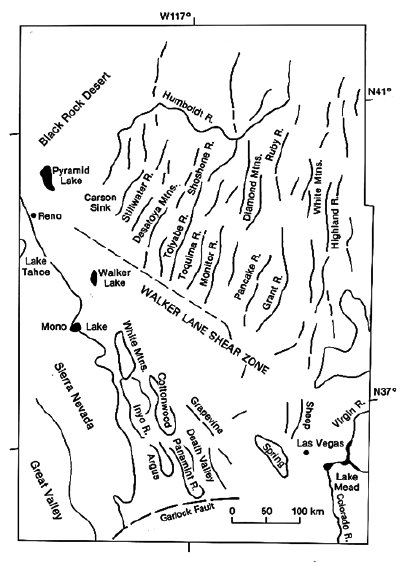
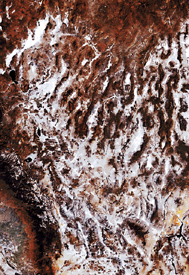
| Image at right shows in the upper half the NE-SW trending mountain ranges and valleys of the basin and range province, whereas map at left shows the names of features and indicates location in SE California. The ranges and valleys in the lower half of the picture (Death Valley, Panamint Range, etc.) also are due to crustal extension but oriented slightly different because of changing stress direction south of the Walker Lane Shear Zone. | |
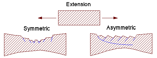
Crustal extension leads to brittle deformation of the upper crust and breakage into slivers that are oriented perpendicular to the direction of extension. It may manifest itself via opposite dipping sets of faults (symmetric), or via faults that all dip in the same direction (asymmetric).
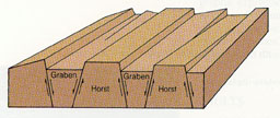
In the picture above we see how in the symmetrical case, we get alternation of uplifted blocks (Horst) that become mountain ranges, and down-dropped blocks (Graben) that form valleys (or basins). This is the basic structure of the Basin and Range Province. The extension is in this case take up by numerous parallel faults that riddle the upper crust.
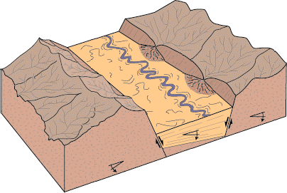
The uplifted blocks become eroded and incised by stream valleys (see above), and the depression formed by the downward moving blocks becomes filled with sediments.
 Movement along the fault planes
between the blocks causes Earthquakes.
Movement along the fault planes
between the blocks causes Earthquakes.