Valley Glaciers: Erosion and Deposition
Erosive Features
|
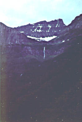
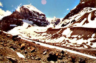
This photo shows a bowl shaped glacial cirque (the area with snow field) that in the past had provided a small tributary glacier to the main valley. Because all the ice has melted, the fllor of the tributary valley is much higher than that of the main valley, and as a result we have a hanging valley. The steep break in slope between tributary and main valley leads to waterfalls (see above center of photo) that come out of the tributary valleys and go down the steep slope of the main valley. |
| The main valley in Yosemite Park. We see half-dome at right, and a large U-shaped valley (Teneya Canyon) in the center of the photo. Because glacial grinding and erosion goes on across the entire width of the valley, the valley is U-shaped rather than V-shaped (typical for stream erosion). | 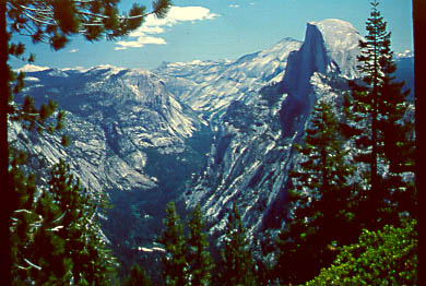 |
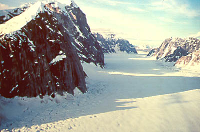 |
This is what Teneya Canyon might have looked like during the last ice age when it was filled with ice and had a glacier moving through it. The picture is from modern day Ruth Glacier in Alaska. |
| A U-shaped glacial valley in the Beartooth Mountains of Montana/Wyoming. You can see hanging valleys and truncated spurs. Talus is building up against the flanks of the valley, gradually covering up the u-shaped erosional characteristics. | 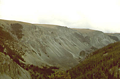 |
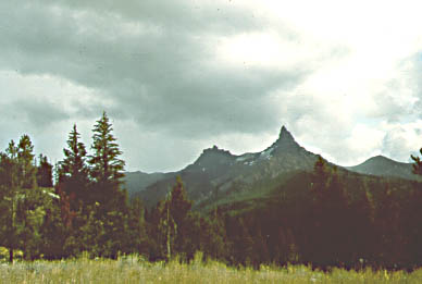 |
A glacial horn in the Bearthooth Mountains. Horns form when several cirque basins on a mountain converge as the grow larger, only leaving a steep spire of rock between themselves. The famed Matterhorn of Switzerland is of this origin. |
| Cirque erosion from both sides of a ridge produces very steep rocky dividers between the two sides, and produce a sawtooth ridge (arete in french). | 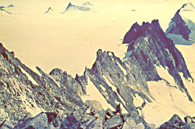 |
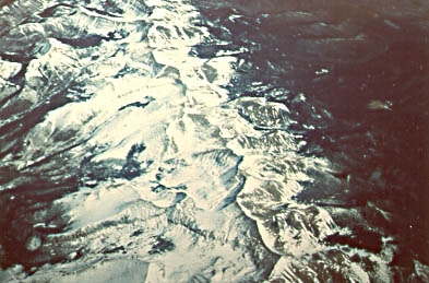 |
A view of the continental divide on a flight between Denver/Colorado and Salt Lake City/Utah. We can see how encroaching cirque erosion from both sides produced a scalloped, rocky crestline. In closeup it looks like the sawtooth ride above. |
| Elongate glacial valleys can be filled with long lakes, if there is some sort of obstacle (piled up glacial sediments, a ridge of resistant bedrock) at the lower end of the valley. They are sometimes called finger lakes because of their shape. The photo shows St. Mary's Lake in Glacier Park. | 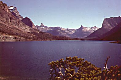 |
Depositional Features
 |
Lateral moraines, Victoria Glacier, British Columbia. The glacier has retreated and we can see the lateral moraine attached to the side of the valley. We also see the poorly sorted nature of the moraine material. |
| Lateral moraines in Owens Valley, California. Glaciers in Owens valley have melted a long time ago, and therefore the lateral moraines have begun to become covered with soil and vegetation. In contrast the moraines in British Columbia have only been very recently been vacated by ice. | 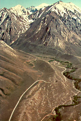 |