 |
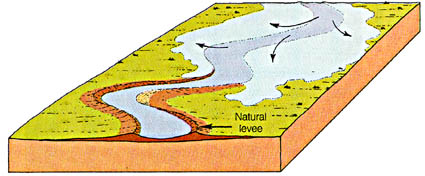
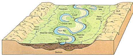
Overview of features associated with meandering streams. A
meandering stream migrates laterally by sediment erosion on the outside of the meander
(that is part of the friction work), and deposition on the inside (helicoidal flow,
deceleration, channel lag, point bar sequence, fining upwards). Adjacent to the
channel levee deposits build up, and gradually raise up the river over the floodplain
(mainly fine sediments). If the climate is humid the floodplain area beyond the levees may
be covered with water most of the time, and may form a swamp (backswamp). Rivers
that want to enter the main stream may not make it up the levee, and empty either into the
backswamp (filing it up gradually) or flow parallel to the stream for a long distance
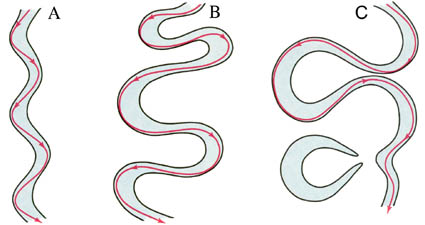
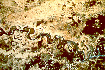
until they finally join (yazoo streams). Meanders may cut into each other as they
grow (neck cutoffs), and then the river shortcuts (growing meanders reduce the
slope, cutoffs are a means to increase the slope again, feedback loop) and the old meander
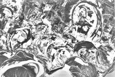
is abandoned and slowly fills with fine sediment during floods (oxbow lakes). Also,
as a river builds up its levees and raises itself over the floodplain, the slope and the
transport power of the stream decrease, the channel fills gradually with sediment, and
finally (often during a flood) the river will breach its levee (this process is called avulsion)
and follow a steeper path down the valley. |